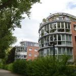
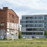
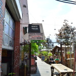
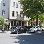
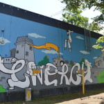
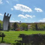
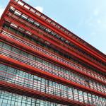
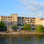
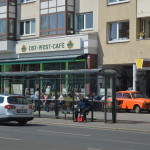
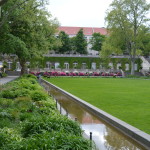
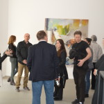
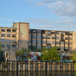
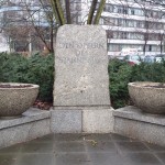
Water on three sides, so centrally located, such wasted opportunities. A lot of really nice flats built and being built, and very idyllic surroundings, but no character, no “personality”, not ONE café or restaurant or shop, apart from a small bakery. Not even any people to be seen, really, for that matter, despite the fact it was a Saturday and many people already live in the area.
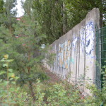
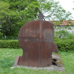
Apparently, the Berlin Wall even divided Stralau
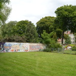
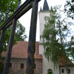
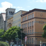
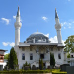
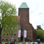
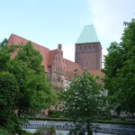
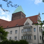
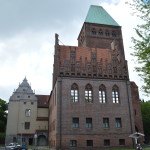
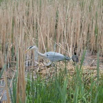
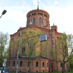
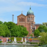
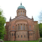
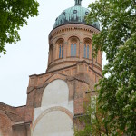
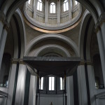
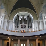
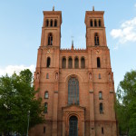
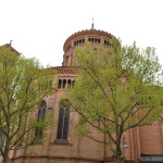
The former Stralau church (still open to the public) has features dating back from the middle ages (a rare thing in Berlin)
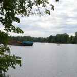
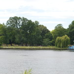
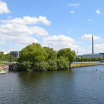
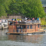
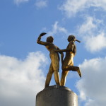
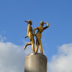
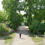
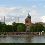
And a few photos from the walk back north from Treptower Park
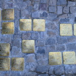
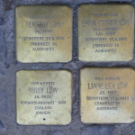
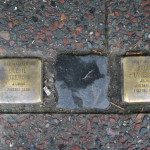
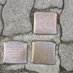
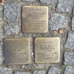
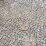
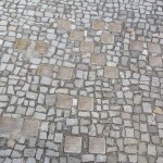
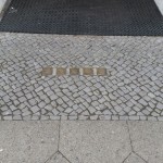
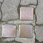
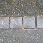
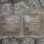
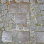
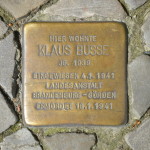
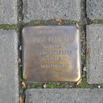
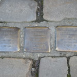
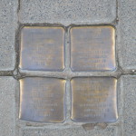
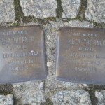
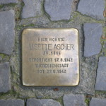
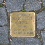
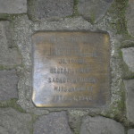
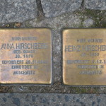
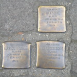
Thomasiusstrasse, just north of Bellevue S-Bahn Station, is a very short stree, so judging by the number of Stolpersteine, it either housed a high concentration of Jewish residents, or one very zealous snitch:
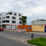
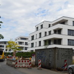
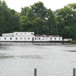
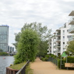
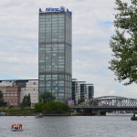
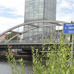
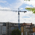
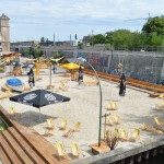
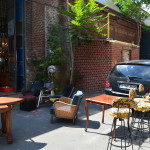
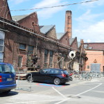
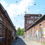
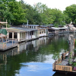
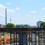
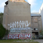
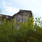
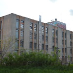
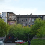
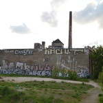
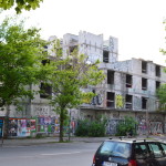
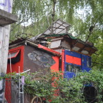
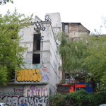
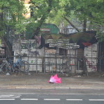
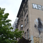
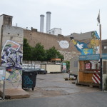
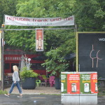
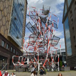
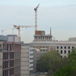
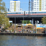
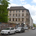
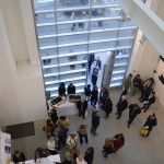
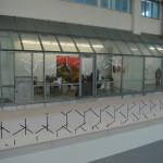
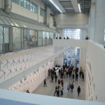
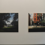
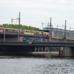
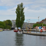
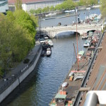
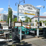
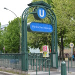
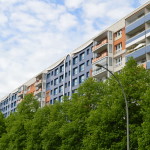
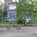
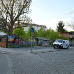
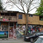
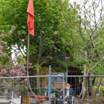
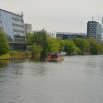
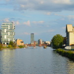
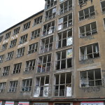
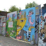
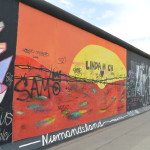
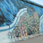
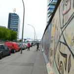
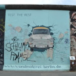
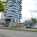
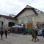
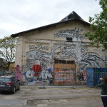
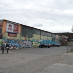
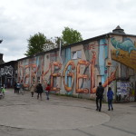
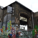
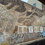
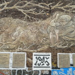
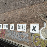
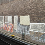
The northernmost part of Köpenicker Straβe, starting from Heinrich-Heine Straβe U-Bahn Station, has received development funding till 2019. Here are some impressions from 2014 and 2015.
So central, so well-connected by public transport, so close to the Spree, such potential. In a few years’ time we won’t remember what it looked like.
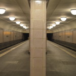
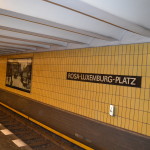
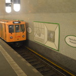
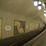
Heinrich-Heine Straβe U-Bahn Station is one of the first stations in Berlin, and like many of them, designed by Alfred Grenander. It was one of the ‘Geisterbahnhöfe’ during the cold war and the main entrance levelled with the ground and covered up. I have not been able to find a photo of the main entrance as it looked originally.
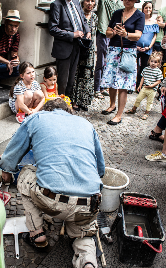
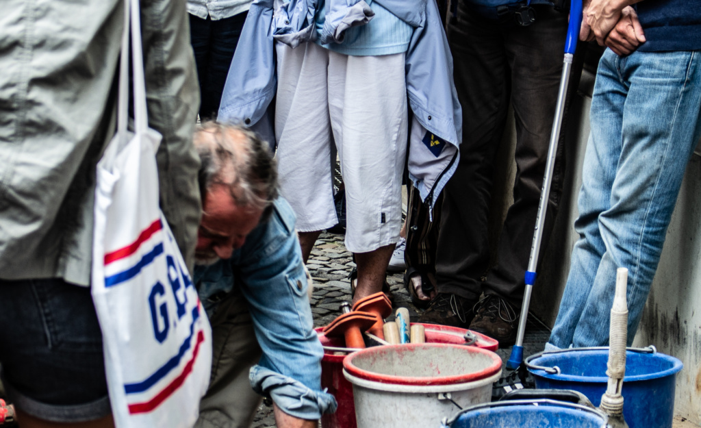
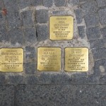
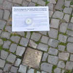
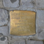
UPDATE: One day in July 2019, I came across a small ceremony, where the artist was laying down some Stolpersteine:
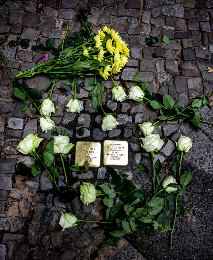
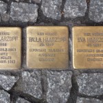
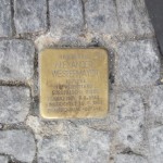
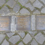
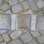
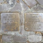
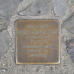
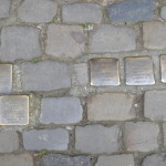
This very moving initiative by the artist Gunter Demnig to commemorate individuals and often entire families wiped out during the Holocaust – Stolpersteine can be found all over Berlin (over 5000), but also in other cities such as Cologne, Rome, …. Read about them here.: http://www.stolpersteine.eu/en/. And read about them in this book: Stolpersteine in Berlin – 12 Kiezspaziergänge. I bought mine at Dussmann das Kulturkaufhaus which, incidentally, in addition to being a huge bookshop including a large section of books in English, has an excellent selection of classical CDs and DVDs.
The app ‘Stolpersteine’ is a great help when walking around Berlin. As you will see below, I always stop and take a photo whenever I spot one or more of them.
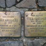
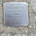
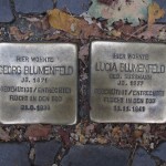
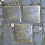
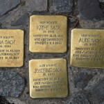
Minna Herrman
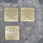
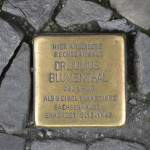
Georg Blumenfeld. Lucia Blumenfeld
The irony …….
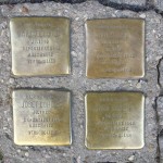
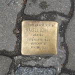
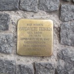
Margarete Teerich
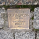
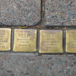
Erna Philippsohn
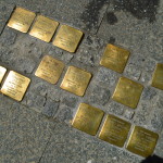
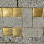
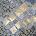
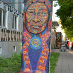
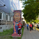
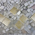
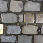
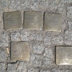
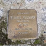
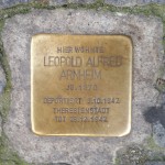
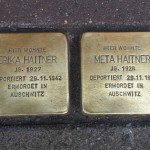
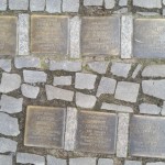
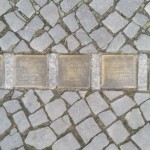
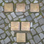
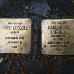
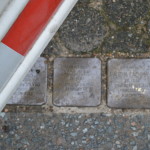
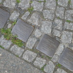
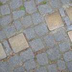
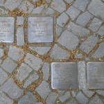
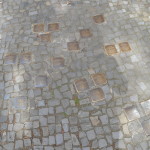
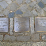
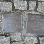
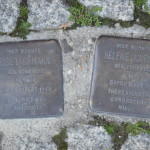
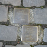
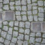
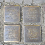
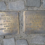
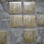
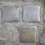
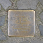
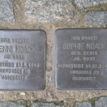
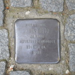
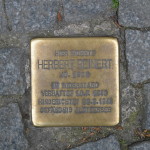
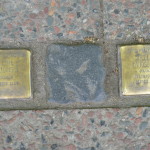
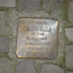
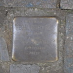
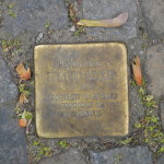
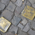
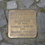
Some more Stolpersteine*)
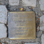
Bertha Fiedler
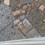
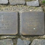
Some more Stolpersteine, also see this post: http://www.hellemoller.eu/?p=1352
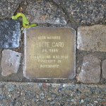
Next time, I’ll polish them myself
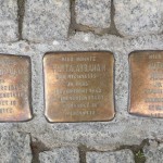
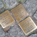
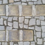
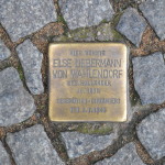
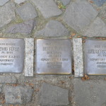
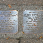
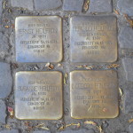
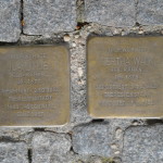
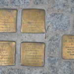
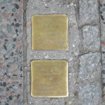
Stolpersteine Outside the synagogue on Pestalozzistrasse 14/15
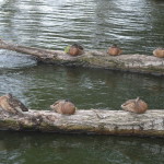
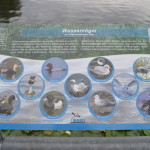
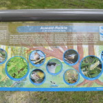
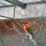
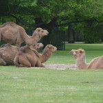
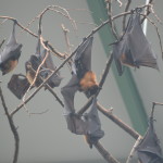
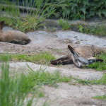
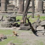
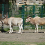
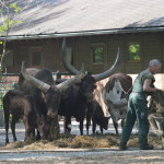
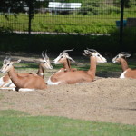
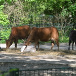
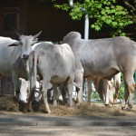
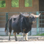
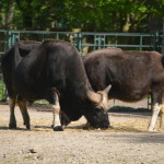
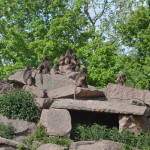
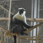
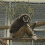
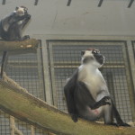
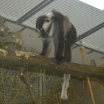
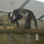
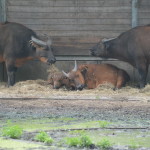
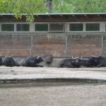
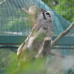
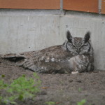
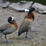
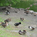
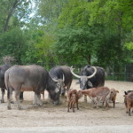
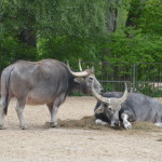
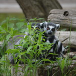
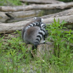
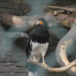
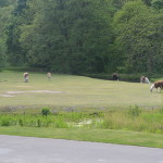
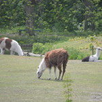
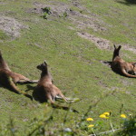
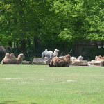
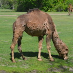
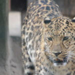
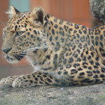
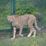
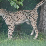
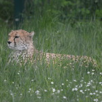
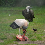
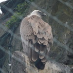
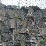
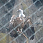
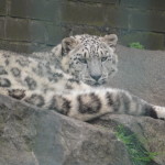
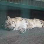
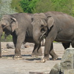
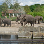
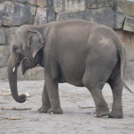
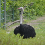
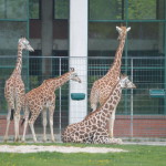
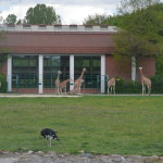
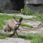
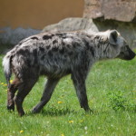
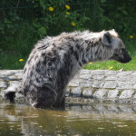
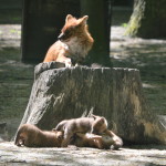
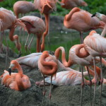
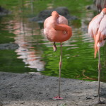
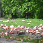
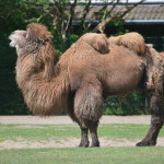
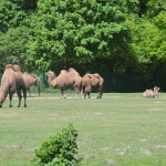
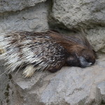
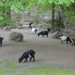
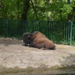
Tierpark Berlin Friedrichsfelde is sadly overlooked, but well worth the short U-Bahn ride from Alexanderplatz. It is Europe’s biggest landscape zoo, and is more like a huge park with the animal enclosures spread over a large area. A lot of walking is involved, and for long stretches, it feels more like being in a forest than in a zoo. There are countless different plants, bushes and trees, a.o. many rhododendron. In recent years, it has become famous for its successful elephant breeding programme, and it is also one of the few zoos in Western Europe that houses herds of ungulates, including some rarely kept species such as Hungarian longhorn, muskoxen and takin.
The only downside, which could easily be rectified so I don’t know why that has not happened yet, is that it is incredibly badly signposted (in strategic places not at all), the map they give you at the entrance is useless, and getting lost is unavoidable. You therefore end up walking even longer than necessary, so wear your best walking shoes. The only useful map is posted just inside the entrance (but for some strange reason only seems to exist in that one copy), so it may be a good idea to take a photo of that one before starting out. Or remember to download one here prior to the visit.
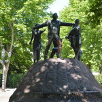
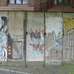
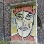
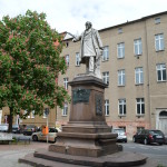
To the right of the entrance are seven preserved segments of the Berlin wall, and a bit further to the right, at the entrance to the Lapidary in Köllnischer Park (http://en.wikipedia.org/wiki/K%C3%B6llnischer_Park), is a memorial statue of the artist/satirist Heinrich Zille (1858-1929). ‘His special talent was the scathingly humorous portrayal of what were in reality quite unfunny life conditions of handicapped beggars, tuberculous prostitutes, and menial labourers, and especially their children, making the best they could of life and resolutely refusing to give up’ (http://en.wikipedia.org/wiki/Heinrich_Zille).
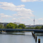
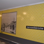
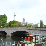
Across the street we descend a few steps to walk along the Spree with a view to Jannowitzbrücke, named after cotton manufacturer Christian August Jannowitz who financed the bridge, built in 1882, destroyed during WW2 and rebuilt in 1954.
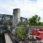
Behind/above it is the station of the same name(http://en.wikipedia.org/wiki/Berlin_Jannowitzbr%C3%BCcke_station) – originally from 1882, but the present form was completed in 1932. It was one of the ‘ghost stations’ for 28 years during the cold war. Straight ahead we have the Mühlendammschleuse http://de.wikipedia.org/wiki/M%C3%BChlendammschleuse_%28Berlin%29, which regulates a difference in water level of 1.5 m.
Turning left on Inselstrasse, on the right-hand side, we pass U-Bahn Märkisches Museum http://en.wikipedia.org/wiki/M%C3%A4rkisches_Museum_%28Berlin_U-Bahn%29, opened in 1913, designed by Alfred Grenander, who designed the majority of the U-Bahn stations at the time. Bonus info: It is one of only two U-Bahn stations in Berlin with no central columns.
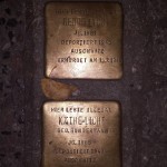
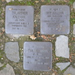
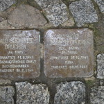
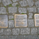
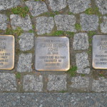
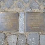
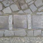
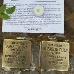
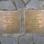
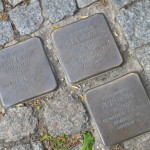
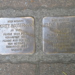
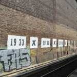
Outside Inselstrasse 12, we find five Stolpersteine (more about Stolpersteine here) – for David and Walter Abrahmsohn, and Ella, Günter and Leo Brauner. It is known that Ella and Günter Brauner were deported on the ’32. Osttransport’ within the ‘Fabrik-Aktion’, and Leo Brauner the day after, on the ’33. Osttransport’.
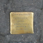
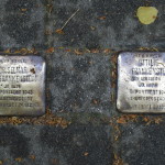
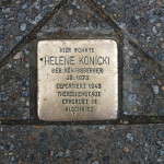
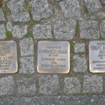
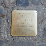
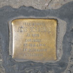
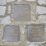
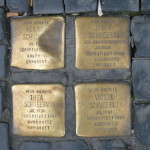
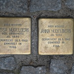
Staying on the right-hand side of the street, now Köpenicker Strasse, we pass three Stolpersteine for Elisabeth, Gertrud and Max Schie, two sisters and a brother, who led a not particularly lucrative existence as dress makers, and were deported to Riga in 1942: http://www.stolpersteine-berlin.de/en/biografie/602. A bit further on, right outside Heinrich-Heine-Strasse U-Bahn station, another one, for Martin Cohn, who was a dentist. After Jews were forbidden to practice their trade in the 1930s (which caused many Jews, especially university-educated, to commit suicide), Martin Cohn continued to treat patients in the Jewish community. He and his wife were deported to and murdered in Auschwitz. They had two daughters. One was sent to the UK at the age of 15 in 1939 and later moved to USA. The other survived Theresienstadt but later died as a consequence of the conditions in the ghetto.
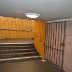
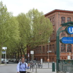
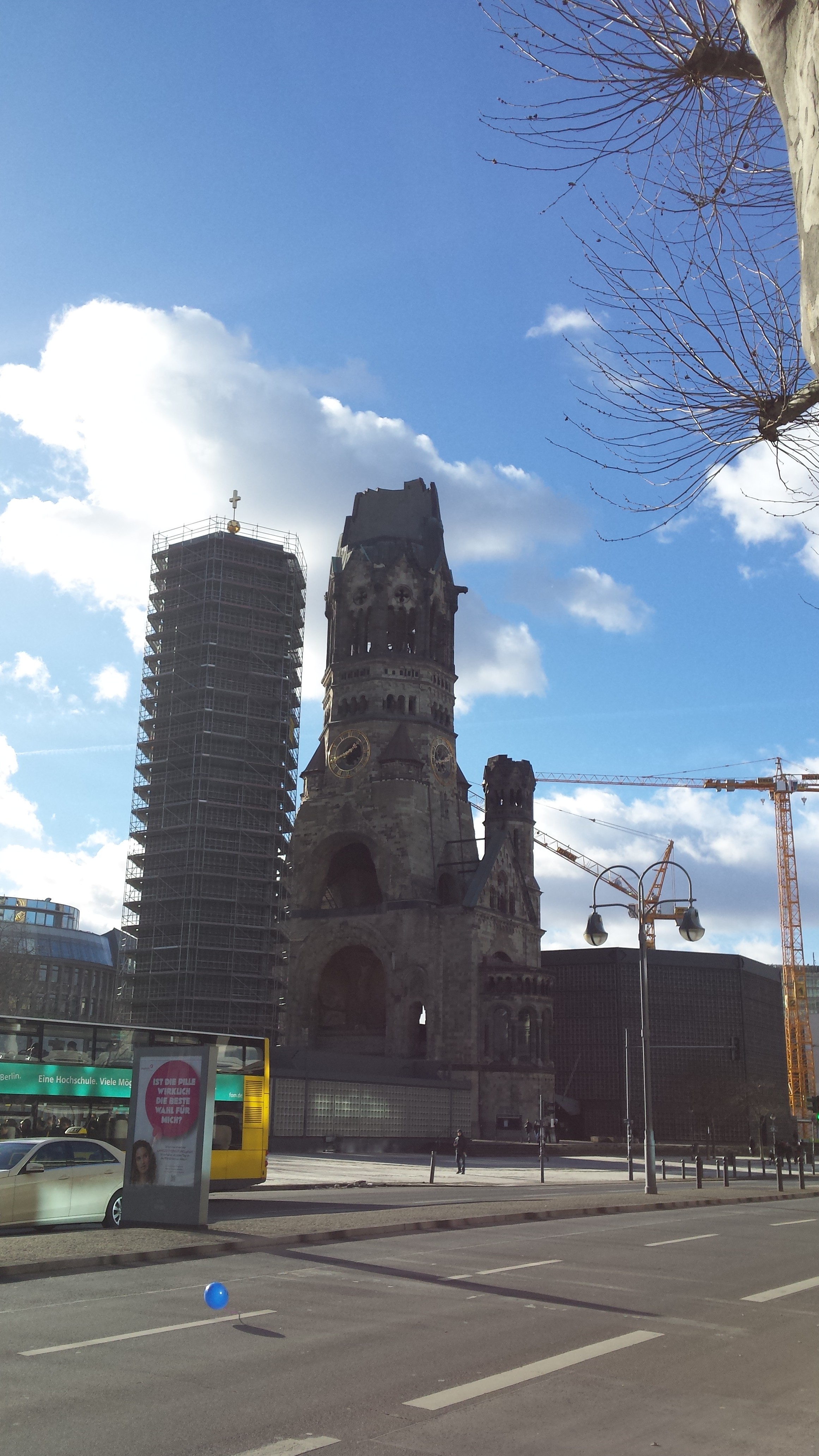
Next we pass Heinrich-Heine-Strasse U-Bahn station, opened in 1928, also designed by Alfred Grenander, and as such a protected architectural landmark. After the construction of the Berlin Wall, the station was closed and blocked to the point that it was invisible from the ground, hence the less than attractive new entrance, and became one of the ‘Geisterbahnhöfe’. http://en.wikipedia.org/wiki/Heinrich-Heine-Stra%C3%9Fe_(Berlin_U-Bahn).
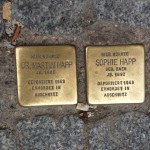
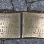
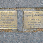
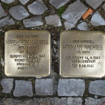
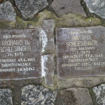
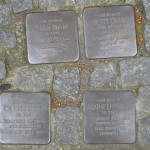
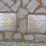
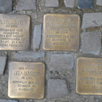
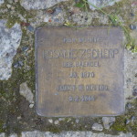
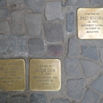
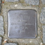
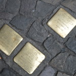
Crossing and turning right into Heinrich-Heine-Strasse, picking up speed to get a boring stretch over and done with, we come across another two Stolpersteine, for Georg and Käthe Licht. In 1941, their daughter Alice had started working in Otto Weidt’s broom and brush workshop (now a museum: http://www.museum-blindenwerkstatt.de/en/ausstellung/themen/otto-weidts-workshop-for-the-blind/), originally recruiting blind and deaf people, and later increasingly recruiting Jews for forced labour. With the help of Otto Weidt, they were able to hide for a while but were arrested and deported on the ‘98th transport’ in 1943 to Theresienstadt, from where the parents were transported to Auschwitz where they were murdered. In January 1945, also with the help of Otto Weidt, Alice managed to escape from Gross-Rosen concentration camp and emigrated shortly after the war to the United States. She died in 1987 in Israel.
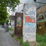
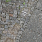
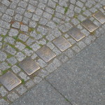
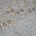
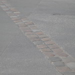
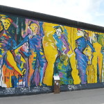
Turning left on Dresdener Strasse, where we meet the row of double cobble stones which in many places, but not all, shows the trajectory of the wall.
From here and for the rest of the walk, we will be following the trajectory of the wall, although it is not always marked.
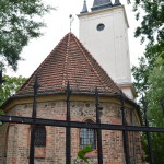
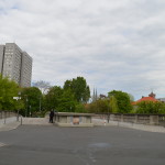
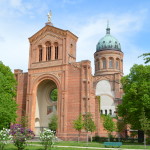
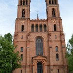
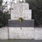
After about half an hour, we meet back on the corner of Leuchnerdamm and Bethaniendamm. Walking along Bethaniendamm we come to the northern corner of Mariannenplatz with St-Thomas-Kirche: http://www.stthomas-berlin.de/, which we have a few minutes to visit if it is open.
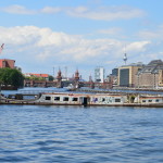
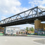
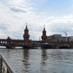
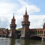
Our walk ends at Oberbaumbrücke http://en.wikipedia.org/wiki/Oberbaum_Bridge, from 1896. During the cold war, from 1963, the bridge was exlusively used as a pedestrian border crossing for West Berlin residents only. Reopened to pedestrians and traffic in 1994, and to U-Bahn in 1995.
In 1997, a neon installation entitled “Stone-Paper-Scissors” by Thorsten Goldberg was installed on the bridge (http://www.secretcitytravel.com/berlin-august-2014/oberbaumbruecke-berlin-art-light-installation.shtml). Its two elements are engaged in a constant game of rock, paper, scissors, suggesting the arbitrariness of immigration decisions, both during the Cold War and for today’s asylum seekers and poverty migrants.
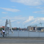
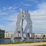
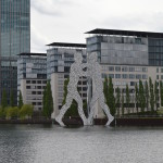
Looking further east along the river, we catch a glimpse of the sculpture ‘Molecule Man’ by US artist Jonathan Borofsky: http://en.wikipedia.org/wiki/Molecule_Man_%28sculpture%29.
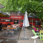
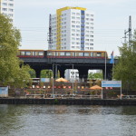
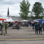
After the walk in May 2015, some of us continued to this beer festival: http://www.braufest-berlin.de/en/.
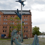
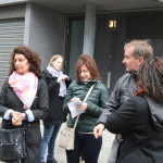
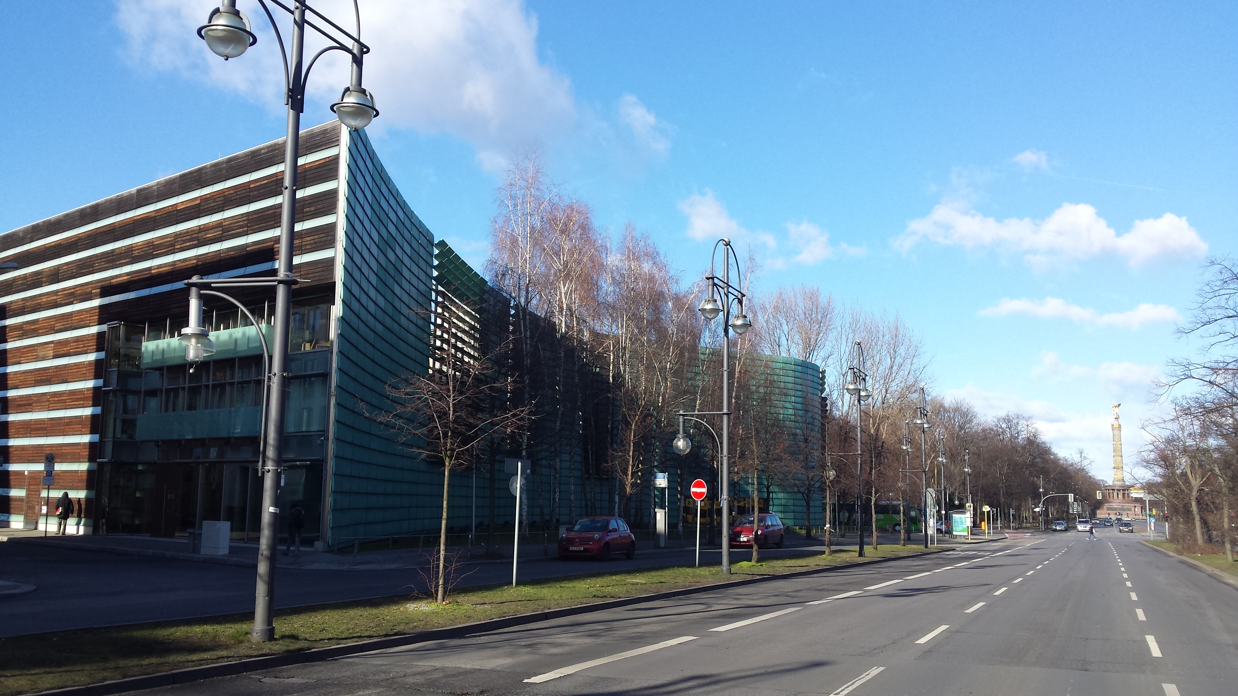
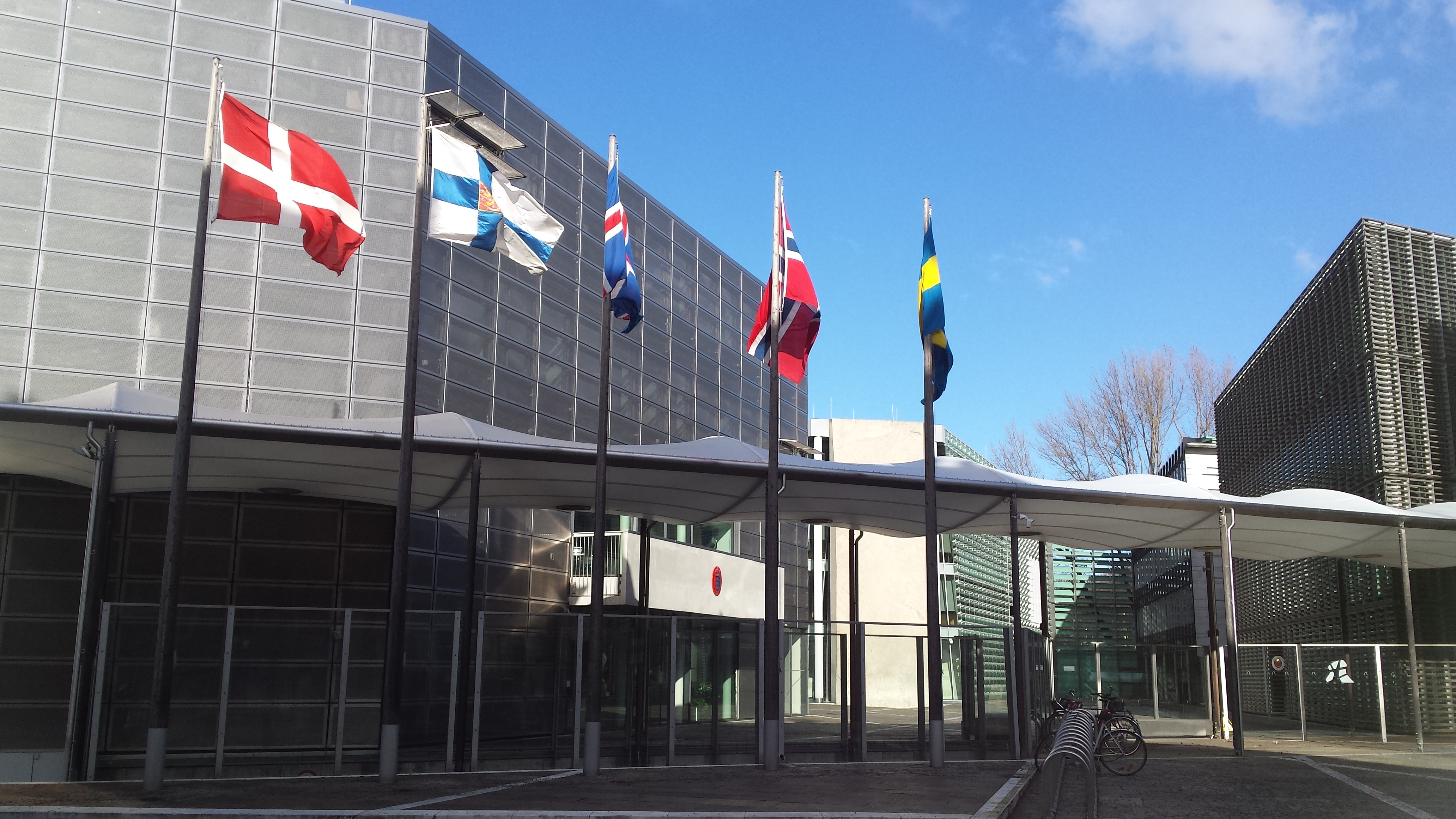
Meeting place: Nordische Botschaften/Nordic Embassies: Among other factors, the wish to utilise the prime location on the south side of Tiergarten efficiently, led to the building of the five Nordic Embassies (Denmark, Finland, Iceland, Norway and Sweden) within one space enveloped by a copper wall. Completed in 1999, the complex comprises six individual buildings arranged geographically, all unmistakenly “Nordic” but each with national distinctive features in terms of architecture and materials used. enveloped by a green, copper clad, snaking wall. We will only be able to peek through the fence to see a little bit of the embassies, but the communal building, housing among other functions an auditorium, a canteen and all five consular sections, is open to the public. Read more here: www.arcspace.com/features/berger…/nordic-embassy-complex/.
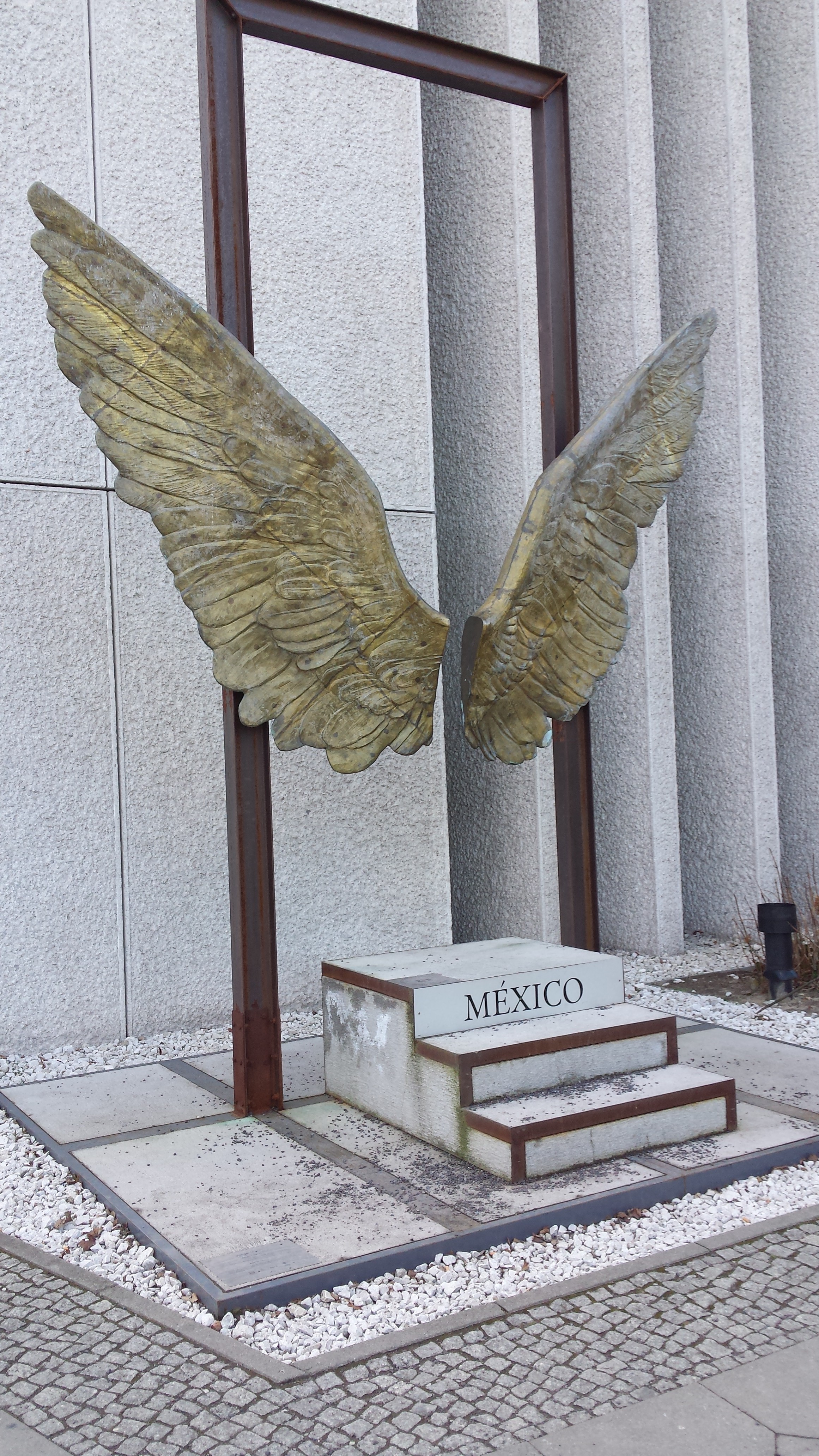
Across the street from the Mexican Embassy …
… and not far from the Siegessäule ….
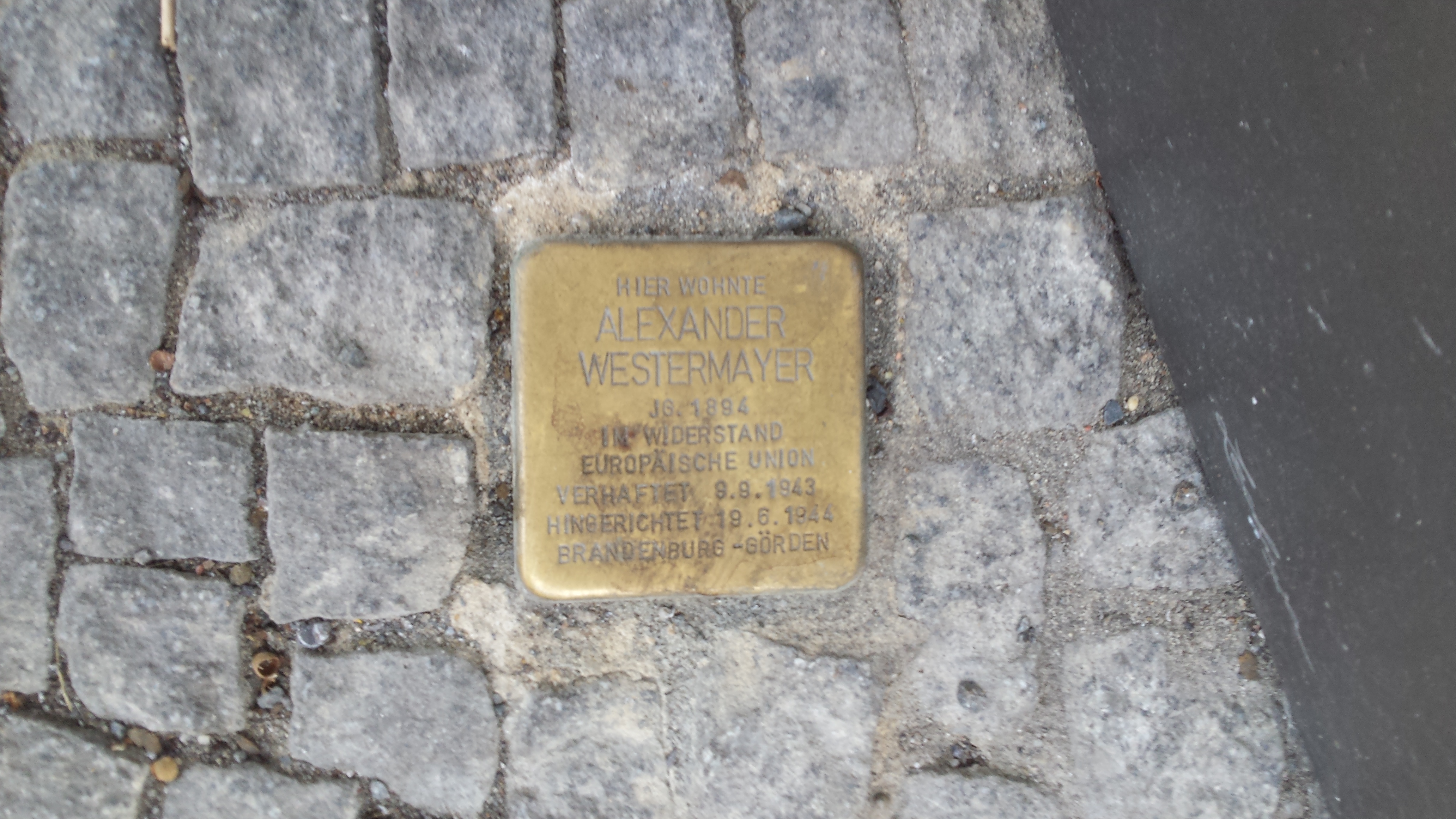
On our way to Wittenbergplatz, we cross the Landwehrkanal via Corneliusbrücke, originally built in the late 19th century, destroyed during the Second World War, and rebuilt in 1954/55. Stolpersteine: (http://www.stolpersteine-berlin.de/en/stolpersteine). Passing along Bayreutherstrasse where at No 41 a Stolperstein commemorates Alexander Westermayer who lived there from 1939 (the original house was totally destroyed towards the end of WW2). Having been one of the founders of “Bund Deutscher Sozialisten”, he joined a resistance group called “Europäische Union”, in 1943, which advocated the restoration of democratic rights and freedoms and a united, free and socialist Europe. The group strengthened intra-German resistance, while sheltering and feeding people, including Jews, persecuted by the Nazi regime and procured them ID cards. On September 9, 1943 Westermayer was arrested, found guilty of high treason and membership of a “subversive organisation” and sentenced to death by guillotine. The sentence was carried out on 19 June 1944 at 15.12 o’clock.
Also in Bayreutherstrasse, at No 38, a Stolperstein commemorates one Edith Bodek, about whose life nothing is known except she was deported to Auschwitz on 29 November 1942 on the “23rd Berliner Osttransport” together with another 997 people. The date of her death in Auschwitz is unknown.
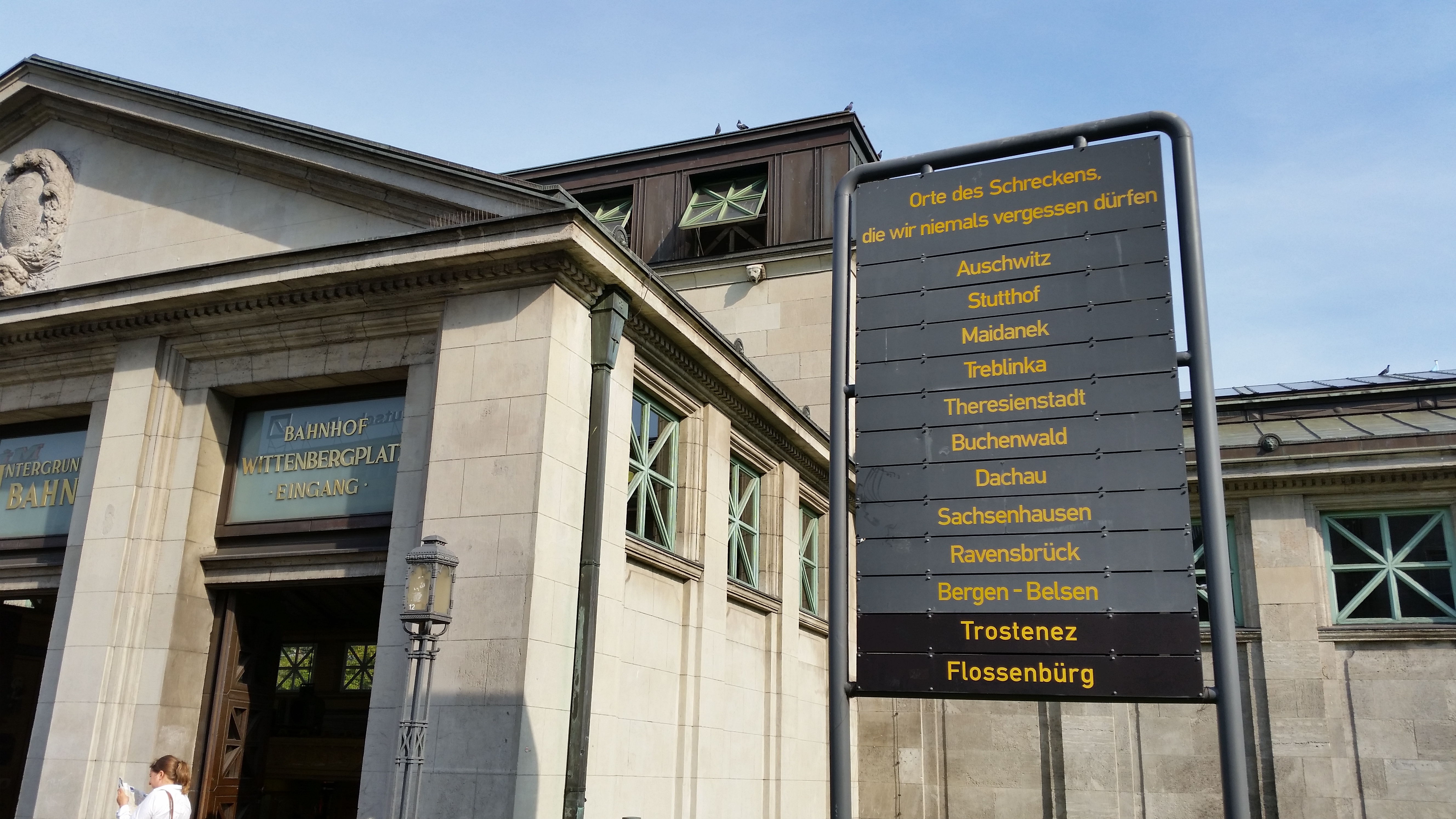
Wittenbergplatz was laid out between 1889 and 1892. Wittenbergplatz U-Bahn station is one of the oldest U-Bahn stations in Berlin, opened on 11 March 1902, and has a remarkable Art Nouveau entrance hall from 1913, designed by Alfred Grenander (Slow Travel Berlin has more about him here: http://www.slowtravelberlin.com/alfred-grenander-architect-of-the-underground/). Outside the western entrance is a monument erected by League for Human Rights 1967 entitled “Places of Terror We Must Never Forget”.
Wittenbergplatz
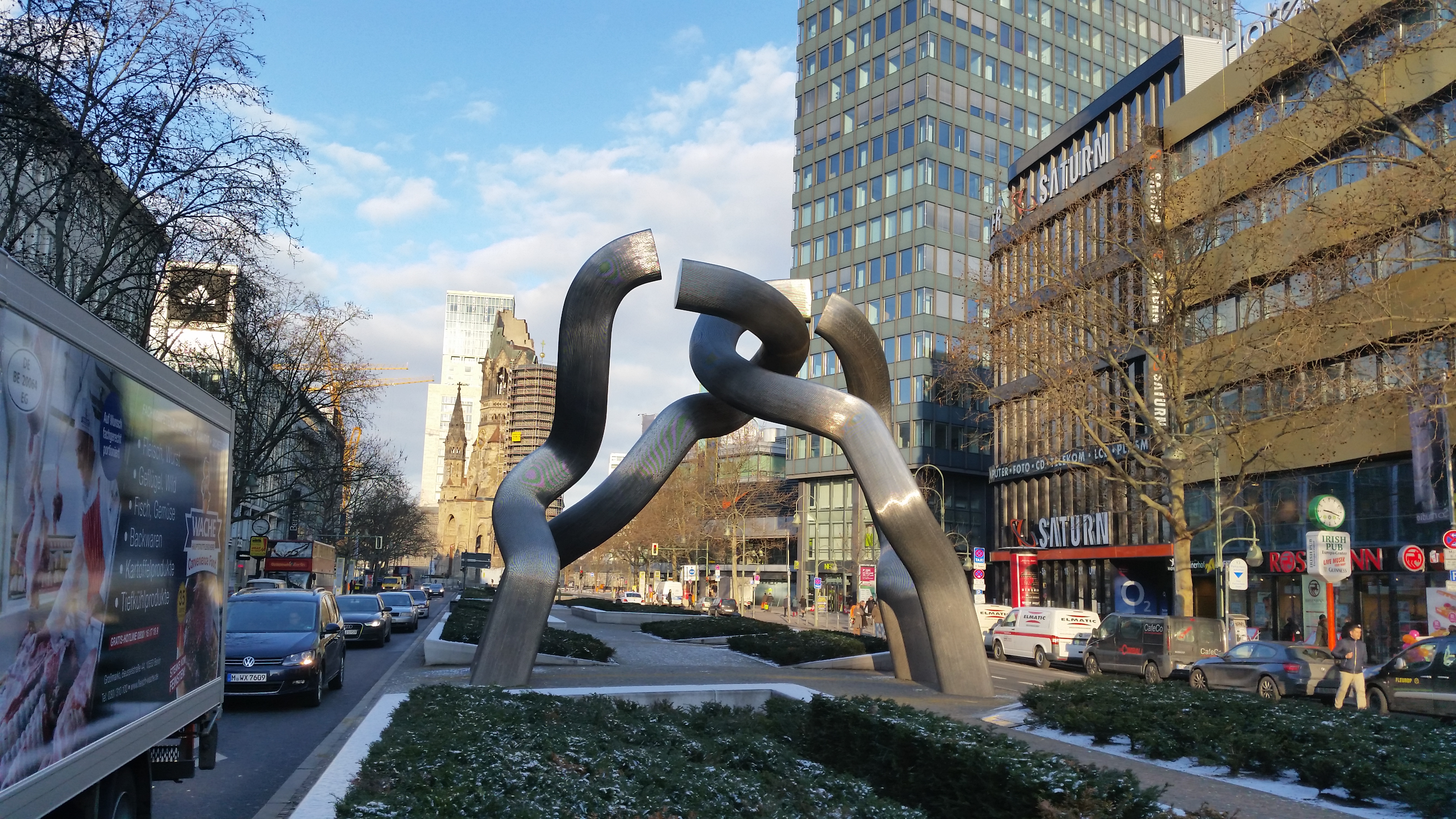
KaDeWe (Kaufhaus des Westens) probably needs no introduction (but if it does, at least go and visit the delicatessen floor – a sight in itself). Brief history: Built by the then famous architect Emil Schaudt, it opened in 1907 with an area of 24,000 sq-m, and is today the largest department store in Continental Europe with 60.000 sq-m. During WW2, allied bombing ruined it, with one American bomber actually shot down and crashing into it in 1943. First two floors re-opening in 1950, full reconstruction finished in 1956. Between 1976 and 1978, the store’s floor space was expanded from 24,000 sq-m to 44,000 sq-m. Just after the fall of the Berlin Wall in 1989, KaDeWe recorded a record-breaking number of people going through the store. Berlin – the “broken-chain sculpture”: From here, looking up Tauentzinstrasse, we also get a glimpse of this familiar sculpture: http://en.wikipedia.org/wiki/Berlin_(sculpture),
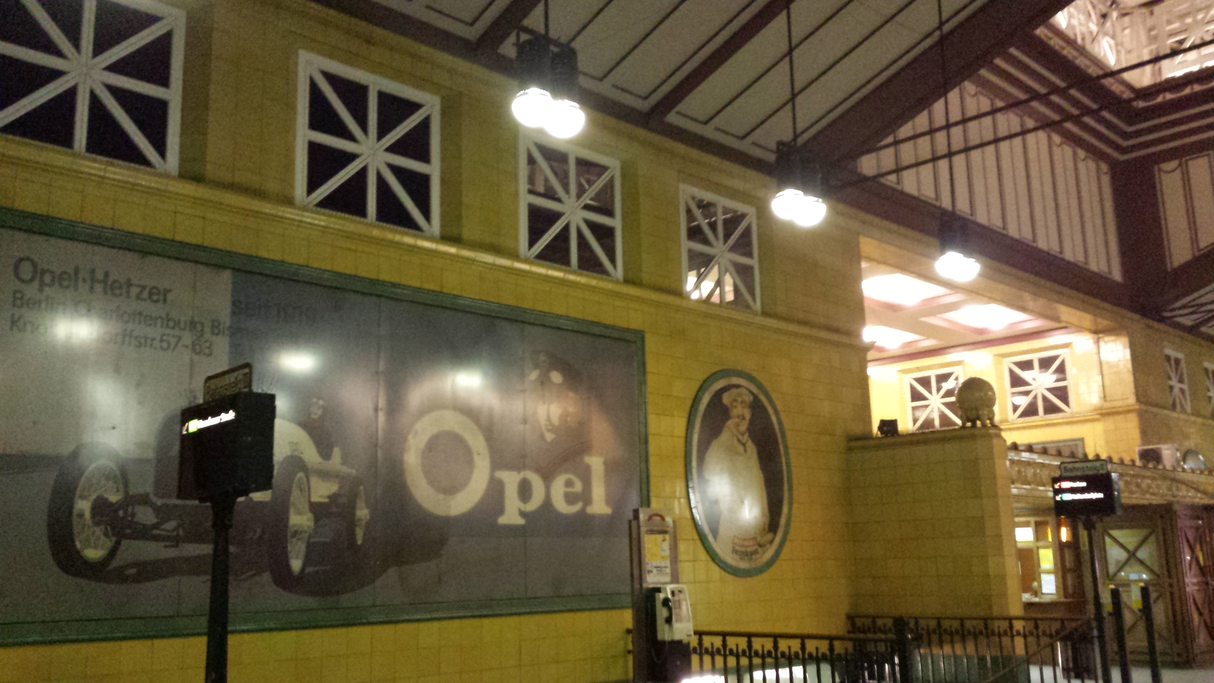
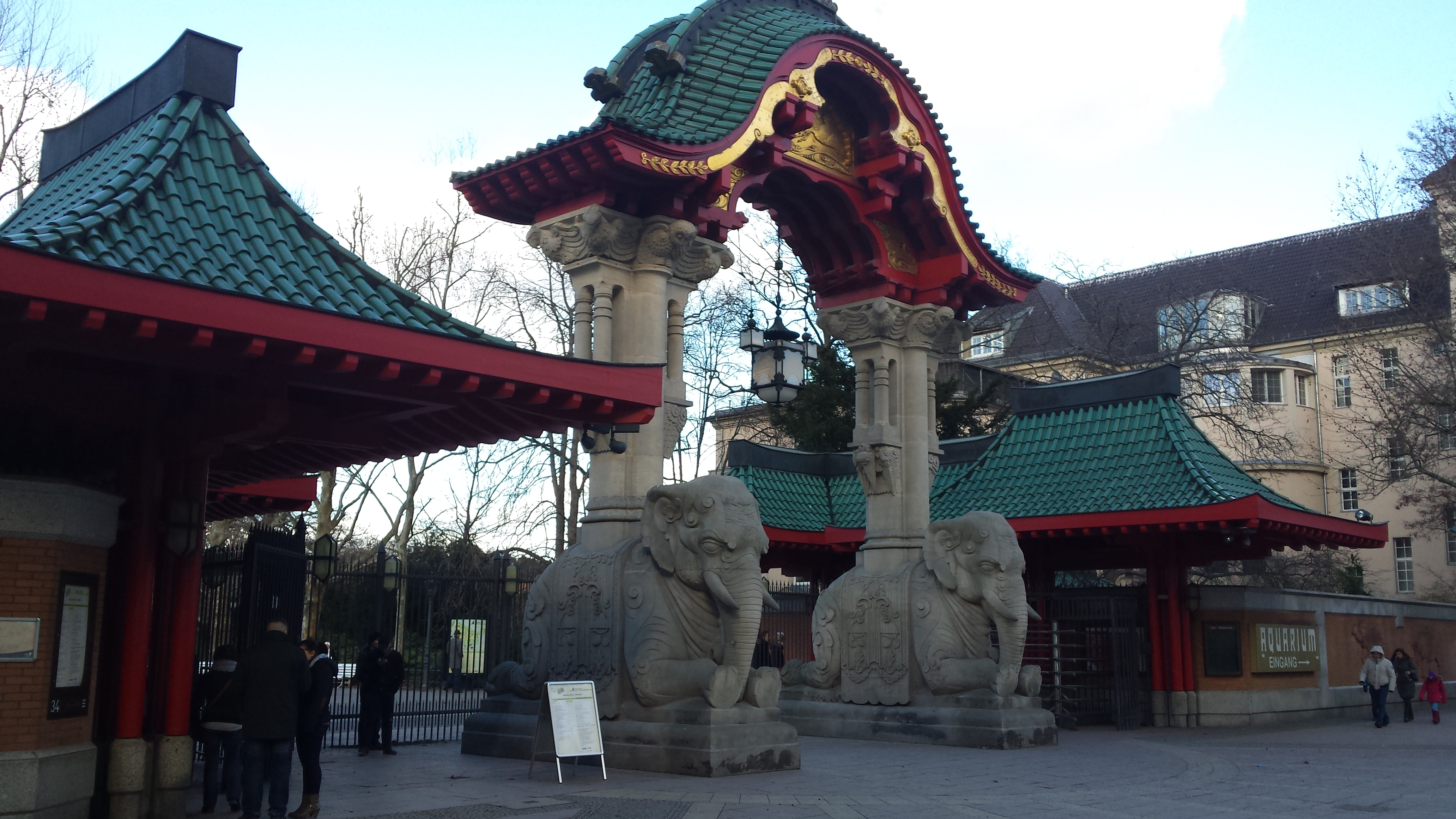
and the Europa-Center, which was built in 1965 as the first modern shopping centre: http://en.wikipedia.org/wiki/Europa-Center. Olof-Palme-Platz, since 1991 named after the Swedish social-democratic Prime Minister who was assassinated in 1986 – a crime that has never really been solved. Elefantentor: Passing the main entrance to Berlin Zoo with the elephant gate, originally from 1899, destroyed during WW2, and rebuilt true to the original, in 1984. Elephants in sandstone, red wooden pagoda.
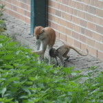
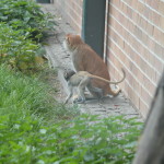
Bikini: In contrast to KaDeWe, the latest shopping centre, or rather “concept mall” – “Bikini” – was opened in late 2013. It is a reconstruction of an existing building from the 1950s, and the original architecture, visible on the façade, is combined with modern utilisation and energy concepts. There is a freely accessible 7000 m² green rooftop terrace on top with a view over the monkey enclosure in the Zoo.
Passing Kaiser Wilhelm-Gedächtniskirche, www.gedaechtniskirche-berlin.de, (after the TV tower probably the most famous of Berlin’s sights, known to the berliners as the lipstick & powder puff, the original church on the site was built in the 1890s. It was badly damaged in a bombing raid in 1943. The present building, which consists of a church with an attached foyer and a separate belfry with an attached chapel, was built between 1959 and 1963. The damaged spire of the old church has been retained and its ground floor has been made into a memorial hall.
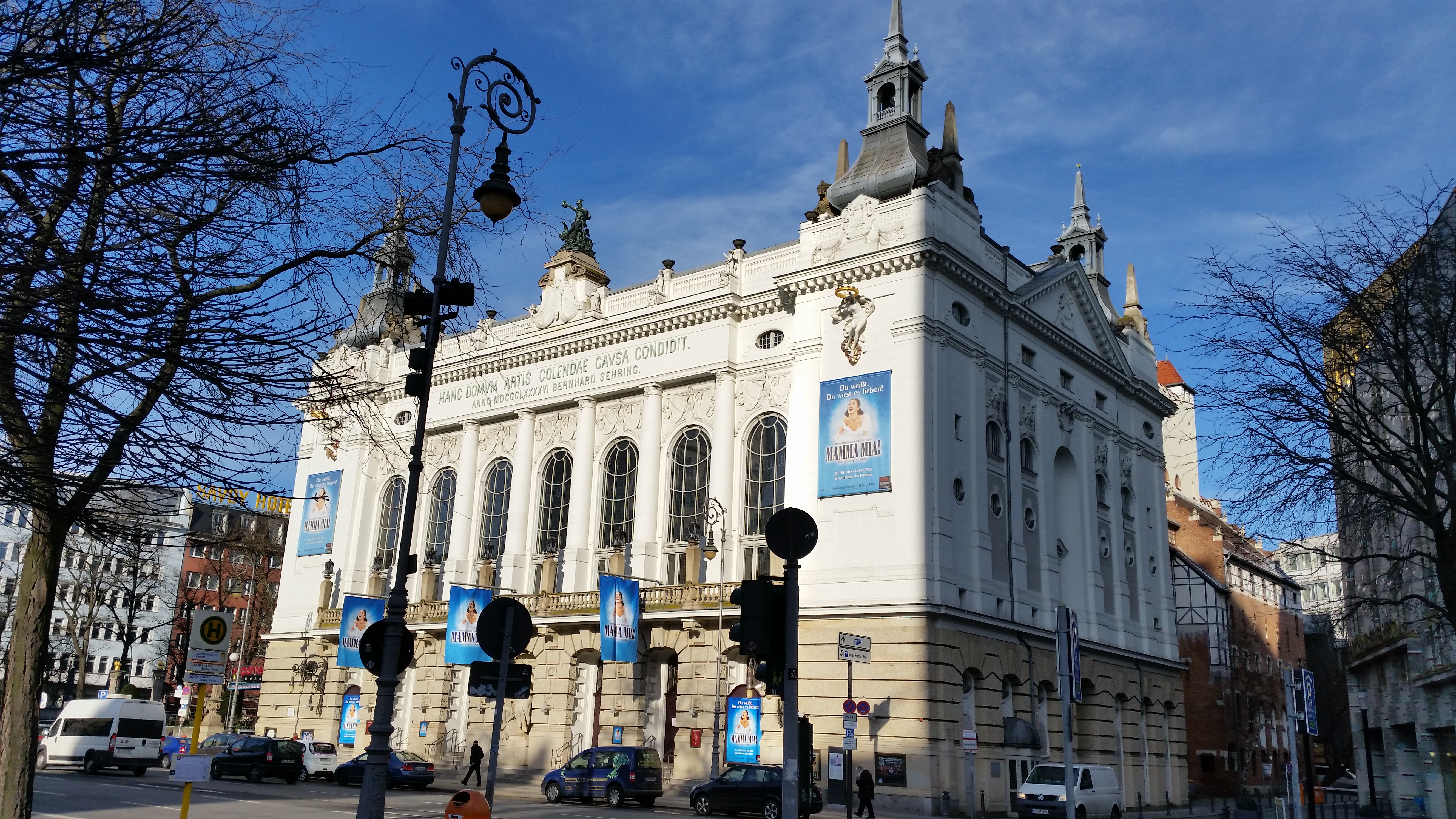
Moving on into Kantstrasse, we pass Theater des Westens built in 1896 in a mixture of Jugenstil and Neobaroque, affectionately called the sugarbowl, the Delphi Filmpalast, and the “Kant-Dreieck” with one of the first “skyscrapers” in Berlin, built by Josef Paul Kleihues, it is 56 m tall and has a huge shark-fin shaped aluminium weather vane on top, turning in the wind like a giant sail. http://openbuildings.com/buildings/the-kant-dreieck-profile-2028.
Bonus info from one of the participants in the walk: The building was built 1992-95 as one of the first new office buildings in the west of the city, designed by Josef Paul Kleihues whose trademark it is to always incorporate steel nails in each tile on the façade. To the right on Fasanenstrasse, another architecturally interesting building is multi-purpose communication centre, The Ludwig-Erhard-Haushttp://www.willebrand.com/project450.html can be seen (but we are not going past it).
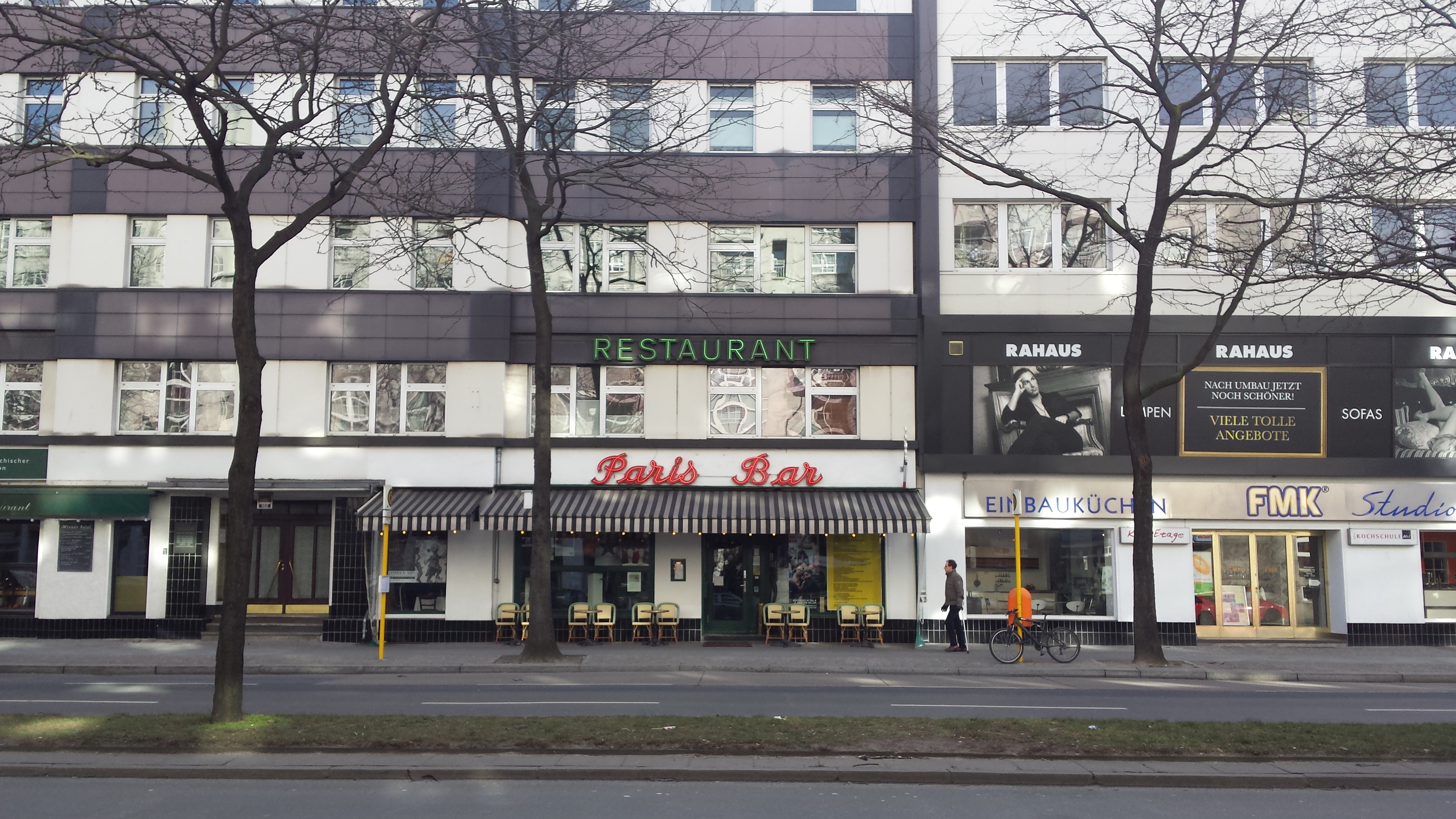
Paris Bar, Kantstrasse 152, used to be THE insider place for artists, actors and media people and boasts visitors from Gorbatjov to Madonna. It is often very busy but it is worth taking a look inside.
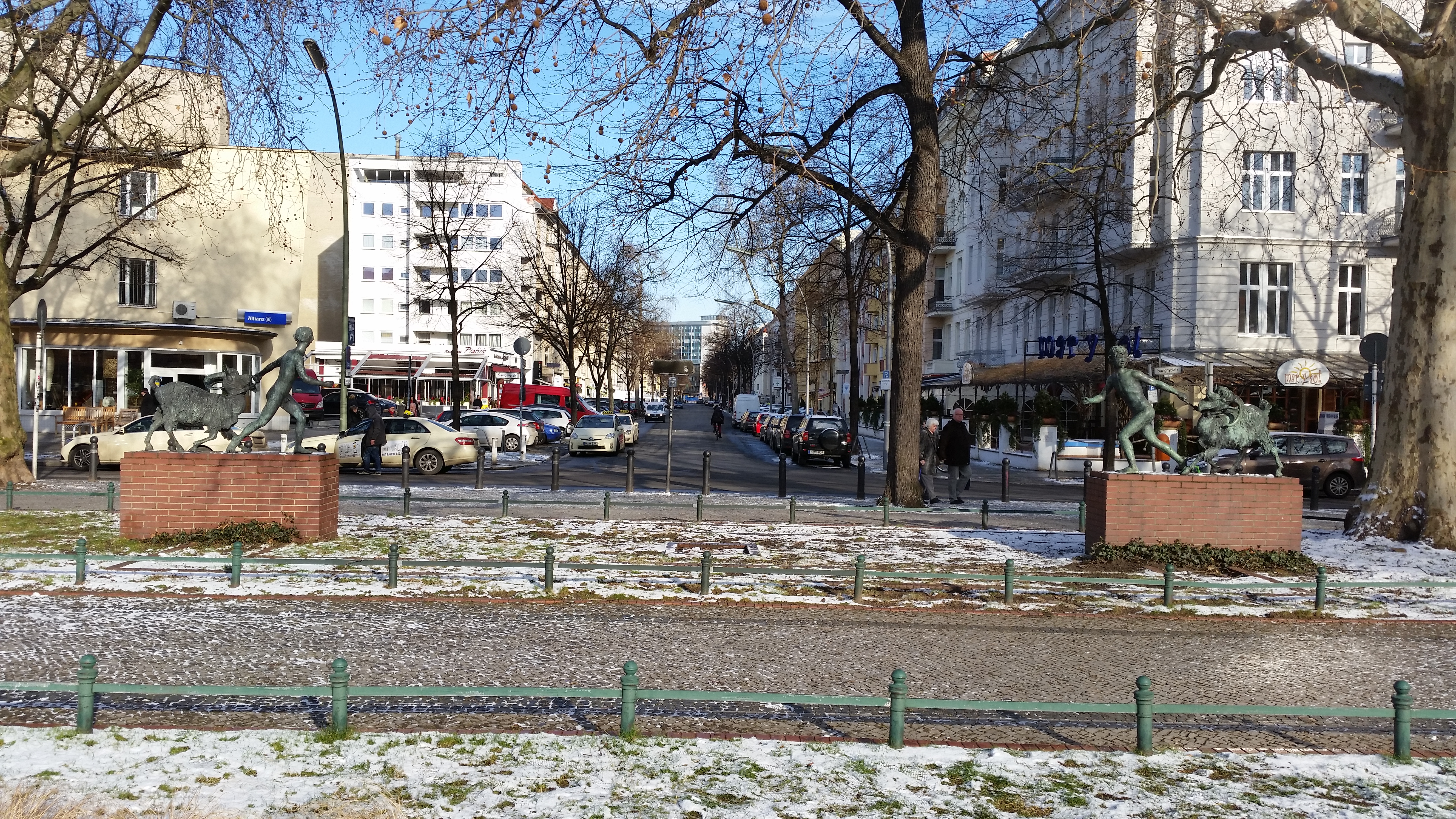
Savignyplatz: The allegedly originaly completely symmetrical Savignyplatz was laid out in 1861, and the S-Bahnhof opened in 1896. The bronze sculptures from 1921 on the north side are by August Kraus.
On the south side a kiosk designed by Alfred Grenander – remember – he of the entrance hall of the Wittenbergplatz U-Bahn station?
On the platform of the S-Bahn station there is a recent mural by Ben Wagin – “Weltbaum II” with environmental messages.
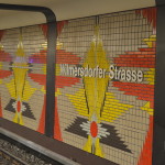
We are on the edge of what is known as Berlin’s Chinatown, with a higher concentration of Chinese and Asian restaurants, shops and supermarkets than anywhere else in Berlin, on and around Kantstrasse between Savignyplatz and Wilmersdorfer Strasse (this part of Kantstrasse is therefore also affectionately called Kantonstrasse). The first Chinese immigrants came to Berlin in the beginning of the 20th century to study at Technischen Hochschule Charlottenburg or Hochschule für Politik. The first Chinese restaurant opened in 1923 in Kantstrasse 130b. In this area, we would also find the former Charlottenburg prison for women, which is now rented out to various art projects.
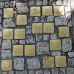
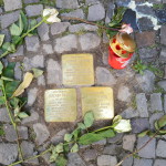
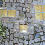
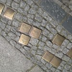
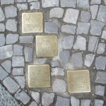
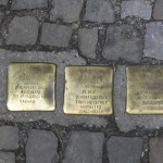
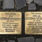
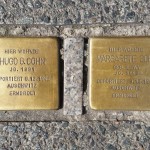
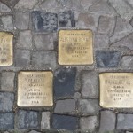
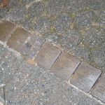
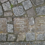
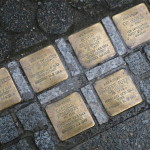
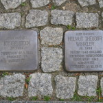
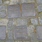
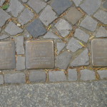
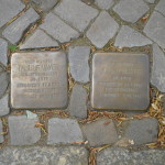
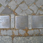
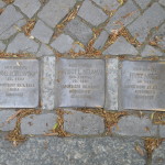
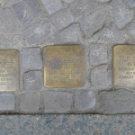
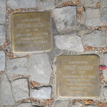
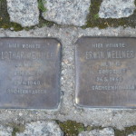
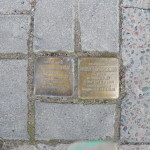
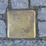
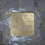
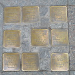
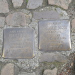
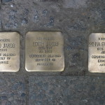
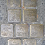
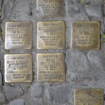
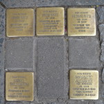
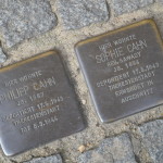
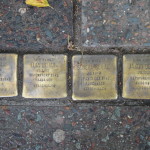
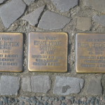
Pestalozzistrasse Synagogue: But we are going up Grolmanstrasse and left on Pestalozzistrasse to No 14/15 and the synagogue, recently re-inaugurated after a major renovation. Outside the building, two clusters of no less than 19 and 21 Stolpersteine respectively, have been laid down. More information can be found here: http://www.stolpersteine-berlin.de/en/stolpersteine. It turned out that only a sign on the wall revealed that it is a synagogue.
Stolpersteine Outside the synagogue on Pestalozzistrasse 14/15
Next time, I’ll polish them myself
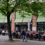
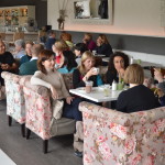
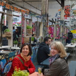
The first we (from the InterNations.org Berlin’s Landmarks group) did this walk, we stopped for coffee and cakes in Café Hardenberg – for me a very nice discovery.
Coming into the home stretch, we go past Steinplatz from 1885, with memorials for the victims of the Nationalsozialismus and Stalinism, and Hotel am Steinplatz, built in Jugendstil by August Endell.
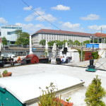
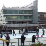
The walk was scheduled to finish at Berlin Zoologischer Garten Station, aka Bahnhof Zoo. The station building overlooks the Hardenbergplatz square, named after Prussian prime minister Karl August von Hardenberg (1750–1822), Berlin’s largest city bus terminal and night bus service centre, and also used by long-distance buses/coaches. The original station opened on 7 February 1882. On 11 March 1902 the first Berlin U-Bahn line, today the U2, was opened under ground. During the cold war, Bahnhof Zoo remained the only long-distance train station within West Berlin. On 28 August 1961, two weeks after the erection of the Berlin Wall, the new U-Bahn Line 9 was opened below the U2, connecting the station with the transportation network in the north-south direction. The fact that with only two platforms and four tracks for long-distance trains the station was still the most important in West Berlin was another unnatural phenomenon of the divided city. After reunification, despite the outcry from nearby Kurfürstendamm retailers and local politicians, the station dramatically lost its importance following the launch of the new Berlin Hauptbahnhof on 28 May 2006, with long-distance services now passing through the station without stopping. Until 2013 the exception was the famous Sibirjak departing from Bahnhof Zoo for the Novosibirsk Trans-Siberian railway station. But a few stalwarts went back to the Bikini mall to see the roof terrace overlooking the monkey enclosures in the Berlin Zoo. Then on to Monkey Bar on top of the adjacent hotel.
And right now a skating rink on part of the roof terrace.
Had the walk taken place during any other season than mid-winter, another good place to finish off would have been the nearby Schleusenkrug Biergarten www.schleusenkrug.de.
I will be organising walks to Berlin’s landmarks such as bridges, towers, parks, remnants of The Wall, stations, notable buildings old and new, Stolpersteine and other memorials, street art, and anything else that might be of interest, things that we have perhaps rushed by without really noticing, within one walkable area at a time, area by area. My sources will be the series in Tagesspiegel on Berlin’s towers, bridges and parks; the books: Ein Jahrhundert Berliner U-Bahn; Berlins Bahnhöfe gestern, heute, morgen; Geisterbahnhöfe, by Heinz Knobloch, Michael Richter and Götz Thomas Wenzel; Berlin.dk (in Danish), by Ole Blegvad og Rasmus Funder; Die schönsten Berliner Stadtspaziergänge, 101 Berlin – Geheimtipps und Top-Ziele für Entdecker; Mauerweg – Stories from the Berlin Wall Trail, by Paul Scraton and Paul Sullivan; 100 favourite places: http://www.slowtravelberlin.com/100-favourite-places/; Stolpersteine in Berlin – 12 Kietzspaziergänge; and websites such as www.abandoned-berlin.de; www.stolpersteine-berlin.de… this list is by no means exhaustive, and I am sure I will be adding to it from time to time and will also be very grateful for any tips anyone might have.
The walks will be posted as activities in this group on InterNations, and details will be posted here. As I am neither a historian, an architect, nor a tour guide, I will not be holding lectures along the way, so it may be a good idea to read the description of the walk beforehand.
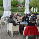
We will of course make pitstops during and after the walks as needed and as opportunity arises.
Language: These are InterNations.org events, so the language is English.
Walk number 3 – memorials and architecture on the edges of Tiergarten